
GeoAI for sound decisions in public space
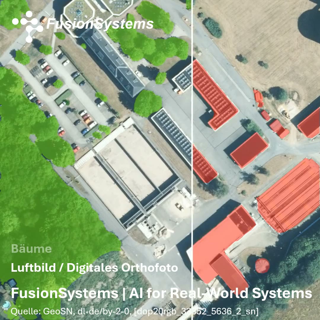
In our demo, we show how AI-based segmentation automatically generates structured object layers from an orthophoto (DOP):
Buildings / trees / vehicles / combined overall view.
Showing and hiding the layers selectively makes visible how a single image becomes an analysable and structured geodata base. With AI-based segmentation, we transform high-resolution aerial images into verifiable, reproducible geodata.
Our GeoAI workflows combine automatic object detection with quality-assured, interactive post-processing and iterative model improvement. Fields of application range from building and surface sealing analyses and vegetation and land area evaluations to agricultural classifications and risk indicators for hazard prevention.
Result:
- significantly reduced processing times
- transparent quality control
- integration into existing GIS infrastructures (also on-premises)
- sustainable data foundations for planning, monitoring, and reporting obligations
We support public administrations, infrastructure operators, and engineering and planning firms in making geodata usable in a structured and economical way.
Would you like to find out what potential lies in your aerial image data?
We are happy to analyse a sample area together with you and show concrete application possibilities.
More on this topic: GeoAI & Spatial Intelligence · Solution: GeoAI Analysis
This post first appeared on LinkedIn. View the post on LinkedIn