AI Technologies
GeoAI & Spatial Intelligence
Analysing spatial information intelligently and combining it with visual and other data.

Industries
Analyse aerial and satellite images, link spatial data and build digital representations of infrastructure and surroundings.
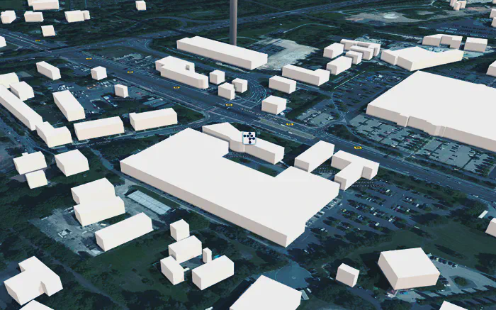
We have been working on map creation, map analysis and geographic information systems for years in our Maps & Navigation field. The AI-based analysis of aerial images builds on this. We work for public administrations, infrastructure operators, and engineering and planning offices that want to use geodata in a structured and cost-effective way.
Cities and regions have large image collections. Their value remains unused as long as every analysis is manual work. AI-based segmentation automatically generates object layers from an aerial image, for example for buildings, trees and vehicles. The layers can be shown and hidden individually, checked and processed further. In this way, an image becomes an analysable, reproducible geodata base.
Automatic detection is only the first step here. Specialists refine the result interactively, and every correction improves the model for the next run. We describe the methods under GeoAI & Spatial Intelligence.
| Field | Example |
|---|---|
| Built-up areas | Record building stock and surface sealing |
| Vegetation | Analyse tree stock and areas |
| Agriculture | Classify areas |
| Hazard prevention | Derive risk indicators from area and object data |
| Change | Detect what has changed between two images |
The results serve as a data basis for planning, monitoring and reporting obligations. They can be integrated into existing geographic information systems, including in your own data centre.
We provide individually prepared map data in two and three dimensions, in the browser or via a dedicated map server. The basis is freely available map data. It is supplemented with cadastral data, aerial and satellite images, and object data obtained from sensor data.
A digital twin becomes outdated when nobody maintains it: construction sites appear, vegetation grows. That is why we also use measurement drives as a source. What a vehicle detects along the way is located spatially and entered into the model. One example is the trial in a district of Chemnitz: AI-Based Environment Perception for Autonomous Public Transport.
The easiest way is with a sample area: together, we analyse a section of your aerial image data and use it to show what can be detected and with what quality. We describe the entire process from the requirement to operation under Visual and Spatial Data Analysis, and the annotation tool under Acotate 2.0 AERO.
AI Technologies
Analysing spatial information intelligently and combining it with visual and other data.
AI Technologies
Image-based and video-based AI, grown out of many years of experience in industrial machine vision.
Solutions
Analysing aerial and satellite images with AI, recognising spatial relationships, and turning geodata into concrete insights.
Projects & References
Our annotation tool for aerial images combines automatic pre-annotation with human correction – the basis for image segmentation that learns.
Projects & References
Perception in the vehicle and the digital environment model of the operating area work hand in hand: what the vehicle detects becomes permanently usable knowledge about the environment.
Whether a first AI adoption or a complex development task – we discuss the requirements and suitable next steps with you.