AI Technologies
GeoAI & Spatial Intelligence
Analysing spatial information intelligently and combining it with visual and other data.

Our own tool
Our annotation tool for aerial images combines automatic pre-annotation with human correction – the basis for image segmentation that learns.
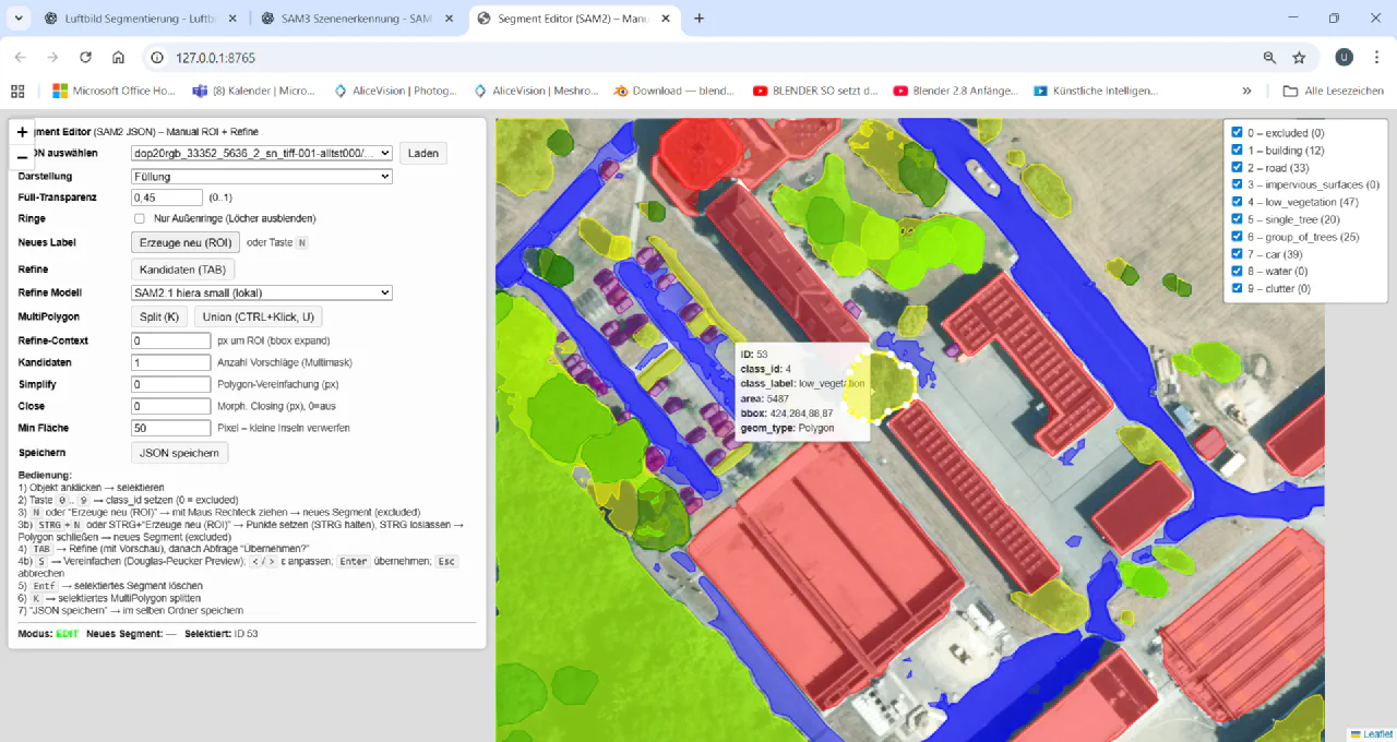
Machine learning in image analysis needs reference data. Creating it by hand is the most labour-intensive part of a GeoAI project.
Acotate 2.0 AERO is one building block in an end-to-end GeoAI process: capture requirements, collect and version training data, annotate, train, validate, adapt to the area of use, deploy and improve in operation. We describe the process under Visual and Spatial Data Analysis.
AI Technologies
Analysing spatial information intelligently and combining it with visual and other data.
AI Technologies
Image-based and video-based AI, grown out of many years of experience in industrial machine vision.
Solutions
Analysing aerial and satellite images with AI, recognising spatial relationships, and turning geodata into concrete insights.
Industries
Analyse aerial and satellite images, link spatial data and build digital representations of infrastructure and surroundings.
Whether a first AI adoption or a complex development task – we discuss the requirements and suitable next steps with you.