AI Technologies
Vision AI
Image-based and video-based AI, grown out of many years of experience in industrial machine vision.

AI Technologies
Analysing spatial information intelligently and combining it with visual and other data.
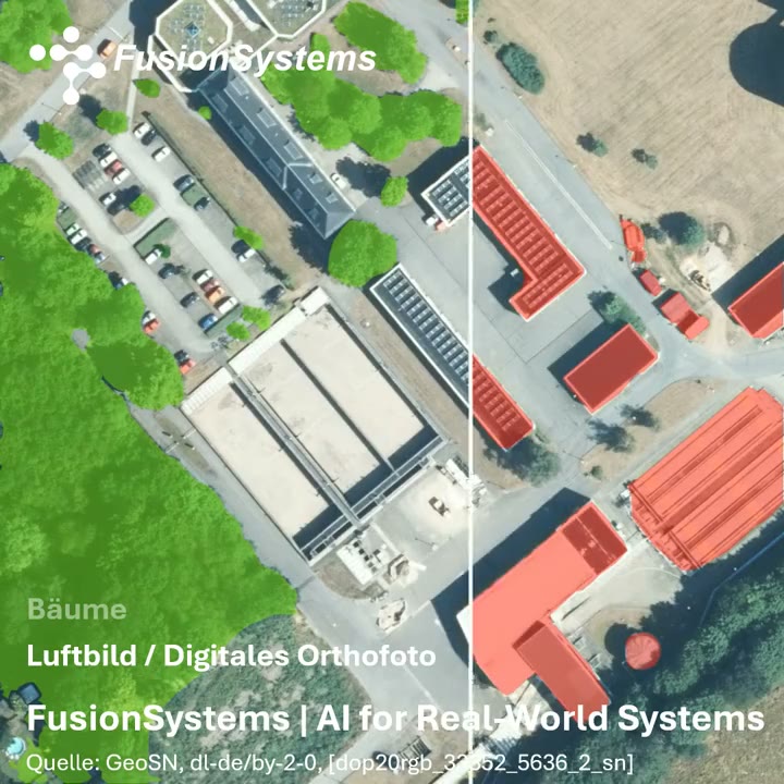
A model must be tuned to the region and the image data of the area of use. We check results against reference data and your requirements; correction by specialists remains part of the workflow.
Smart cities, infrastructure planning, and environmental monitoring need meaningful geodata. For this we combine two perspectives: the analysis of aerial and satellite images from above and the detection from measurement drives on the ground. Both produce spatially located information that can be used permanently.
Semantic segmentation assigns every pixel to a class: building, tree, vehicle, area. For this we use a convolutional network of the U-Net architecture. The class areas yield outlines, and the outlines yield object layers that can be individually shown and hidden, checked, and processed further in a geographic information system. In this way, an image becomes a structured, reproducible geodata base.
A segmentation model is only as good as its reference data. Creating that data is the most labour-intensive part of the work, and this is where our tool Acotate 2.0 AERO comes in:
Every correction improves the model for the next cycle, and in the process it adapts to the area of use.
An aerial image shows the area, but not everything that matters on the ground: traffic signs, traffic lights, road markings. Measurement drives provide this information. Every detection in the vehicle is spatially located and entered into the digital environment model. Conversely, the aerial image helps the vehicle put its detections into context. How both sources work together is shown by the project AI-Based Environment Perception for Autonomous Public Transport.
| Field | Example |
|---|---|
| Built-up areas | Building stock and soil sealing |
| Vegetation | Tree population, area analysis |
| Agriculture | Classification of areas |
| Hazard prevention | Risk indicators |
| Mobility | Digital environment models for automated vehicles |
We provide the results in such a way that they fit into existing geographic information systems, including in your own data centre. We describe the complete workflow, from the requirement through training data, training, and acceptance to monitoring in operation, under Visual and Spatial Data Analysis.
AI Technologies
Image-based and video-based AI, grown out of many years of experience in industrial machine vision.
AI Technologies
Combining information from different physical measurement sources – camera, radar, LiDAR, and other sensors – as the basis for systems that act in the real world.
Solutions
Analysing aerial and satellite images with AI, recognising spatial relationships, and turning geodata into concrete insights.
Industries
Analyse aerial and satellite images, link spatial data and build digital representations of infrastructure and surroundings.
Projects & References
Our annotation tool for aerial images combines automatic pre-annotation with human correction – the basis for image segmentation that learns.
Projects & References
Perception in the vehicle and the digital environment model of the operating area work hand in hand: what the vehicle detects becomes permanently usable knowledge about the environment.
Whether a first AI adoption or a complex development task – we discuss the requirements and suitable next steps with you.